Connect with UPP Arts:
About
UPP Arts
Mashapaug Pond
Staff & Board
Funders
Legacy Project
Arts
School-Based Arts
>
2017
2016
2015
2014
2013
2012
2011
Public Arts
>
2016
2015
2014
2013
2012
2011
The Procession
Educational Resources
Educational Resources: Highlights
Educational Resources: Mashapaug Maps
Educational Resources: Oral Histories
Educational Resources: Indigenous Culture
Educational Resources: Water
Educational Resources: Huntington Industrial Park
Educational Resources: Gorham Site Clean-Up
Educational Resources: Partners & Related Projects
News & Events
Media
Blog
Video
Audio
Photos
Publications
In the News
Get Involved
Public Events
Volunteer
DONATE
Contact
EDUCATIONAL RESOURCES
Highlights
|
Mashapaug Maps
|
Oral Histories
|
Indigenous Culture
|
Water
|
Huntington Industrial Park
|
Gorham Site Clean-Up
|
Partners & Related Projects
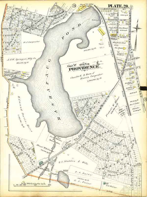
1850 map of Mashapaug Pond
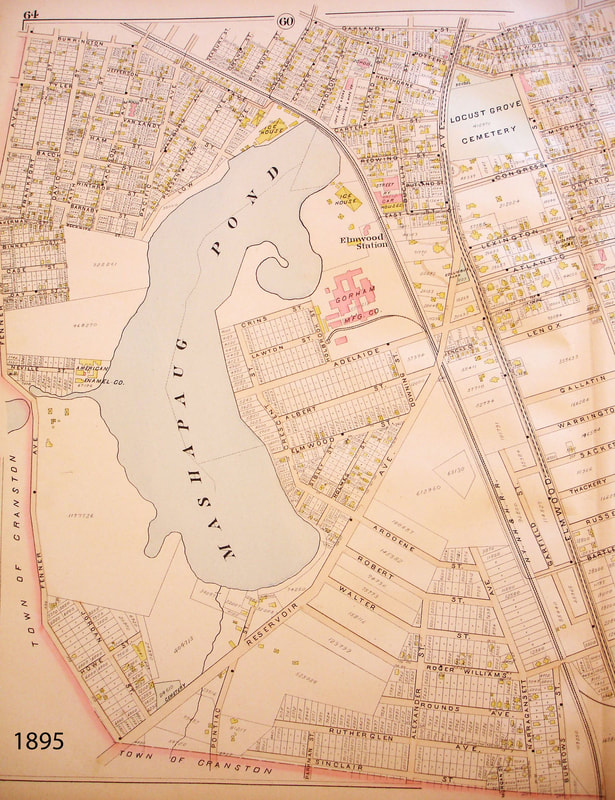
1895 map of Mashapaug Pond
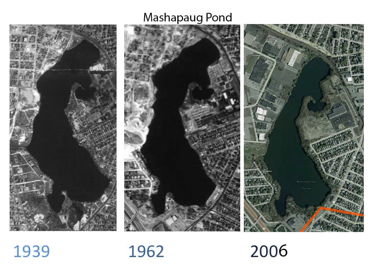
Aerial views of Mashapaug Pond in 1939, 1962 and 2006
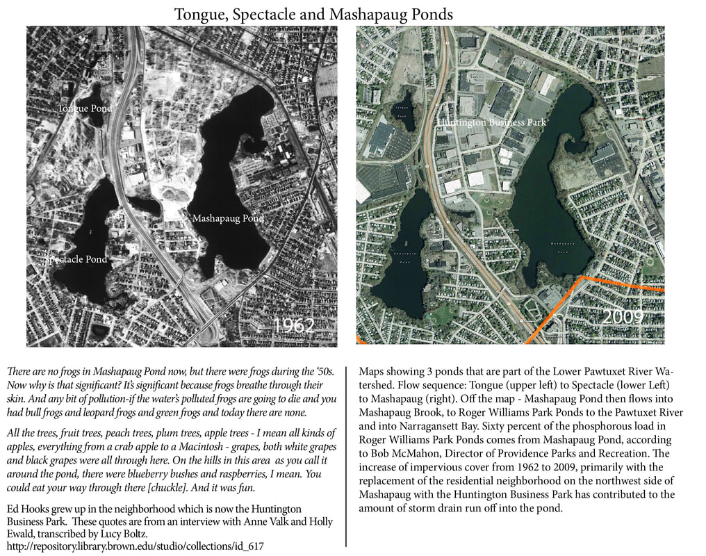
Aerial views of Tongue, Spectacle and Mashapaug Ponds in 1962 and 2009
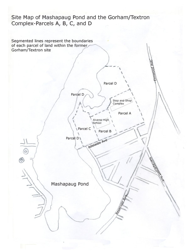
Map of Gorham/Textron parcels
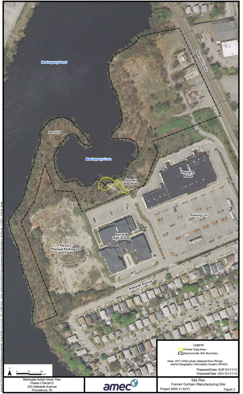
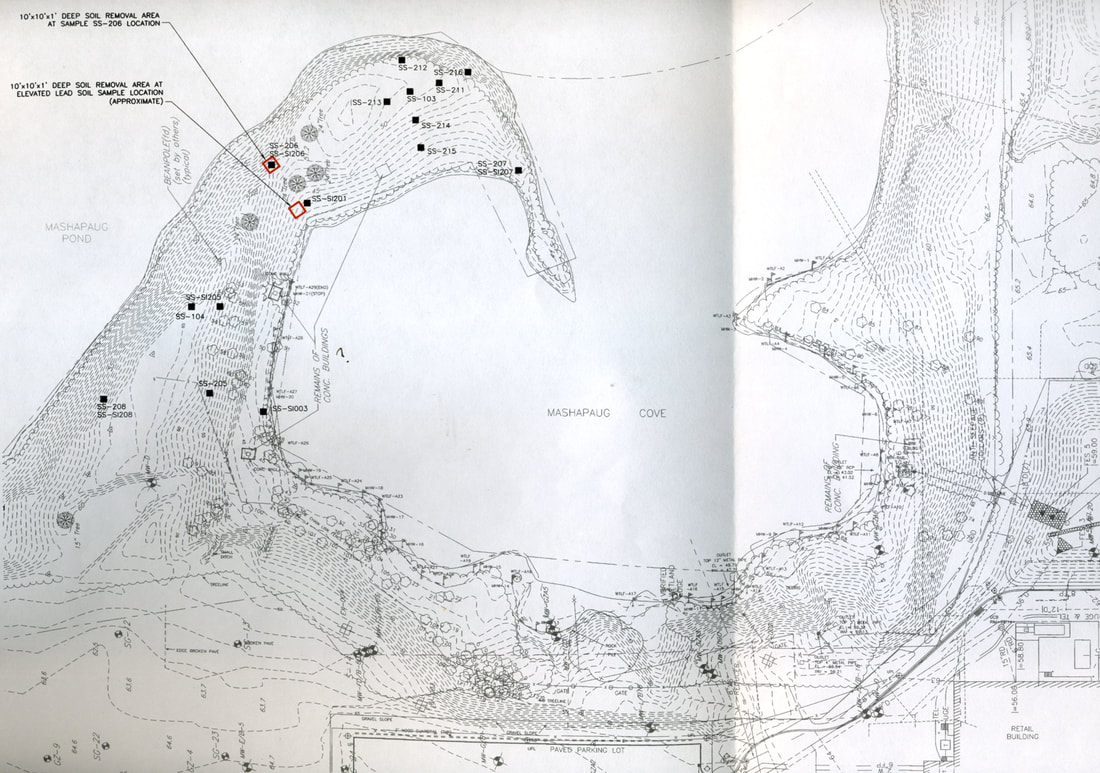
Remediation map
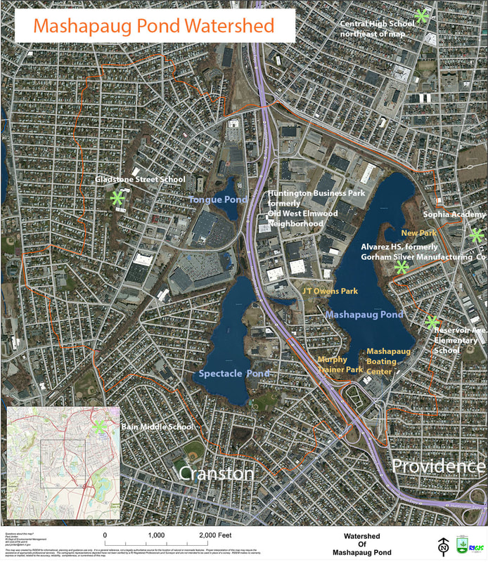
2009 map of the Mashapaug Pond Watershed
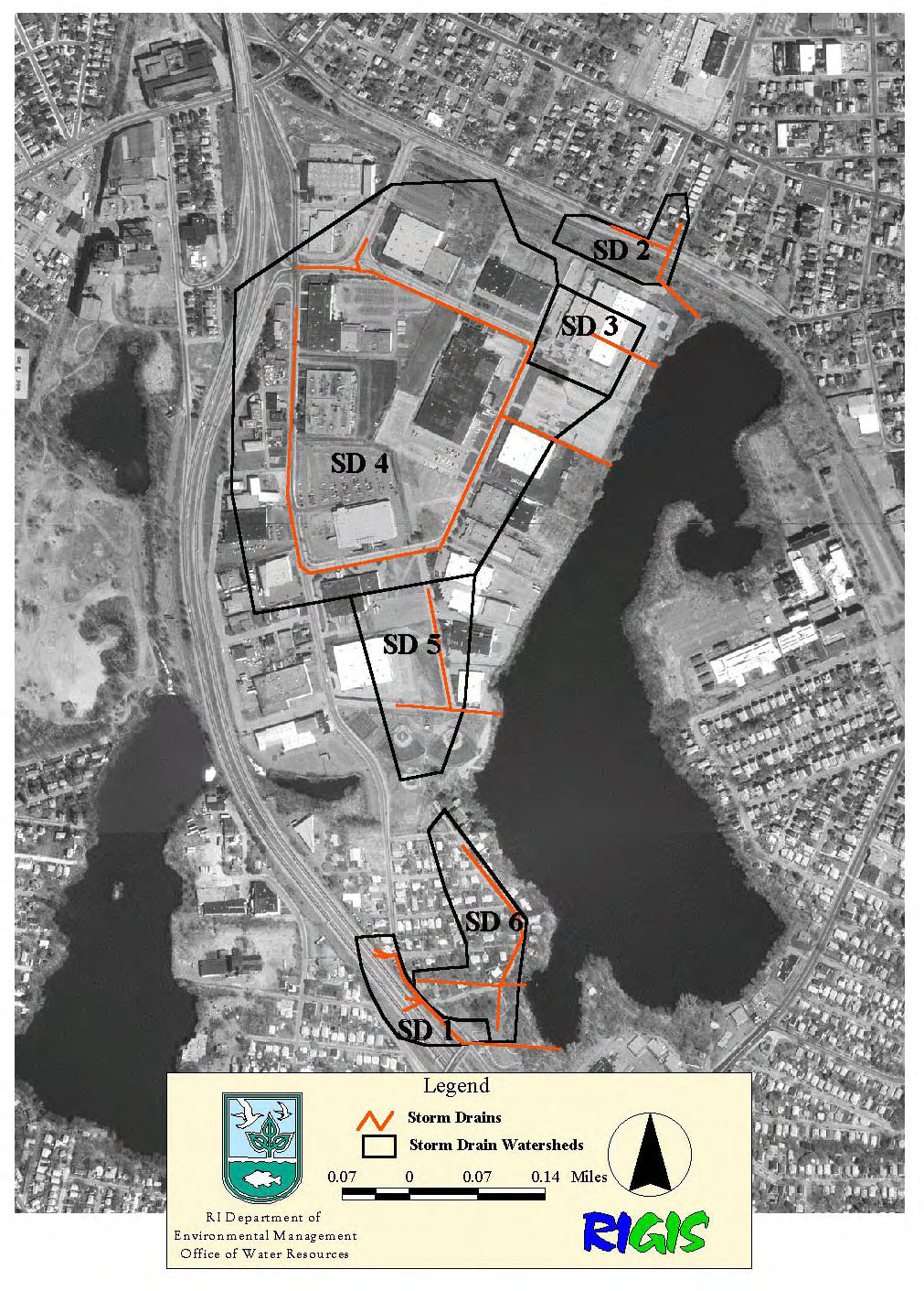
Industrial Park drainage map
Topographic map of Mashapaug Cove